
Architectural 3D Laser Scanning & BIM Modeling
Capture every detail of your building with high-precision laser scanning — converted into accurate, intelligent BIM models for seamless planning, renovation, and design integration.

Precision Architectural Surveys and BIM Modeling for Existing Structures
We specialize in architectural surveys and BIM-enabled models for all types of structures. Utilizing state-of-the-art 3D laser scanning technology from Leica Geosystems, we ensure precise measurements and detailed digital representations for advanced planning and analysis.

Construction Monitoring with 3D Laser Scanners
Using advanced 3D laser scanners, we conduct comprehensive geometric and volumetric analyses of both fresh and dry structures quickly and accurately. This technology allows us to continuously monitor construction geometry and dynamically update project plans in real-time to reflect the current state of the construction site.

Palicje konstrukcija
Precise measurement of structural rod assemblies

3D Measurements and Drawings for Commercial Spaces
We provide comprehensive 3D measurements of commercial spaces, completing the process in under an hour. Our services include creating precise plans and 3D models of the entire property inventory.
3D Laser Scanning for the Built Environment
Capture Reality with Precision
3D laser scanning (3DLS) is a powerful tool for both new construction and the renovation or restoration of existing structures. It delivers unmatched accuracy, speed, and comprehensive data capture, making it indispensable for today’s built environment.
Using advanced laser scanning technology, we measure all visible surfaces — even in complex, irregular, or hard-to-reach areas — with exceptional detail. This non-contact, remote sensing method allows for the digitization of spaces that are otherwise difficult or unsafe to access.
We offer high-precision 3D measurements and modeling for both public and private buildings at any stage of construction, reconstruction, or renovation. Our process aligns with Building Information Modeling (BIM) standards and utilizes industry-leading tools such as Autodesk Revit for seamless integration into the client’s project workflow.


3D Laser Scanning Products
-
3D Point Cloud High-resolution digital capture of geometry and color from all visible surfaces. Serves as the base for measurement, modeling, and analysis.
-
2D Plans Precise architectural and construction drawings derived from the point cloud. Sections and views can be generated from any angle. Delivered in *.dwg format to match client standards.
-
3D CAD Models & BIM Accurate models of existing conditions in CAD, mesh, or BIM formats. Created in Autodesk Revit with LOD and templates based on project requirements.
-
Visualization Immersive visual outputs using scan data and 360° imagery. Supports virtual walkthroughs and presentations via web or VR platforms.
-
Deviation & Shape Analysis Compares scan data to design models to detect deformations, misalignments, and dimensional deviations. Essential for quality control and structural verification.
Selected Projects

3D Scanning for Power Plant Maintenance and Retrofit Engineering

Viltus Castle; Ceilling 3D scan

Sport’s Hall; 3D scan & Model
Existing conditions survey & BIM modeling

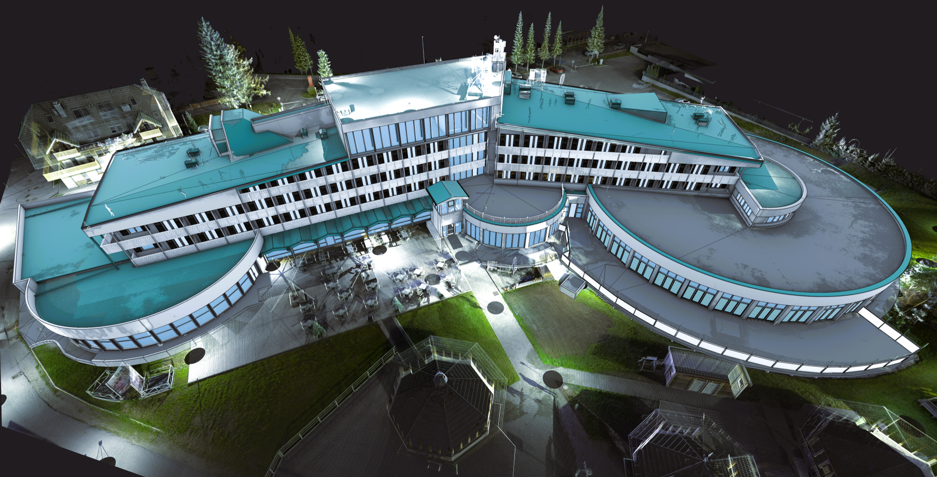
Architectural Survey & BIM; Hotel

New Delftse Poort; @Rotterdam

Rustical house; Heritage preservation

Pavillion; Pointcloud to 3D CAD and 2D drawings

Fast food restaurants chain, 3D scanning for interior design

Podčetrtek castle; 3D scanning & Photogrammetry

St. Mihael Church; 3D scanning for heritage preservation
